|
Mexico M7.4 earthquake (2012/Mar/20) 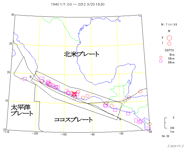 Fig. 1 : M>=7 from 1940 from PDE by USGS. The red cross shows the epicenter of March 20 event. The black line shows th plate boundaries. MM 7 was estimated at the epicenter area by USGS. USGS PAGER 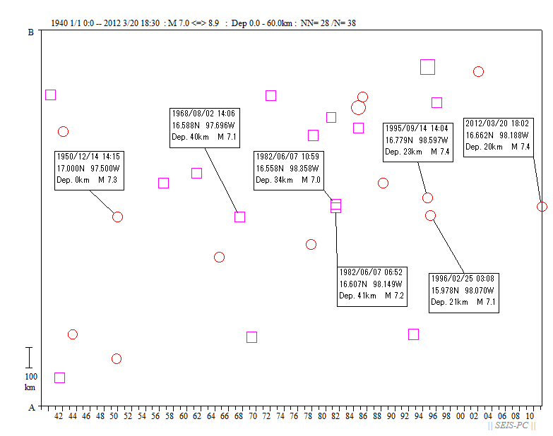 Fig. 2 : The time-space tisdtirbution of the ellected events along the west coast of the middle America. 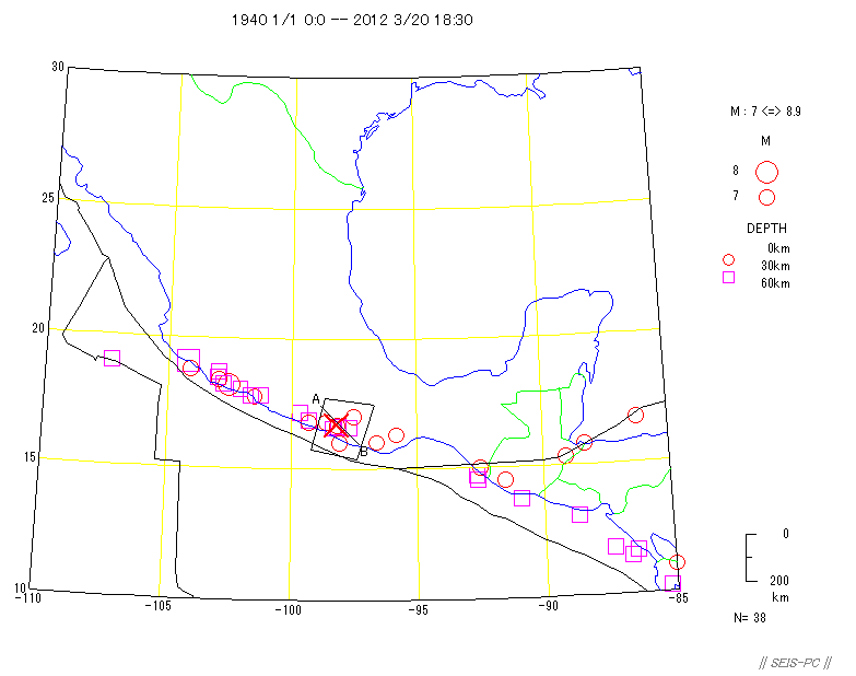 Fig. 3 : The same map as fig.1. The cutout area will be used in next figures. 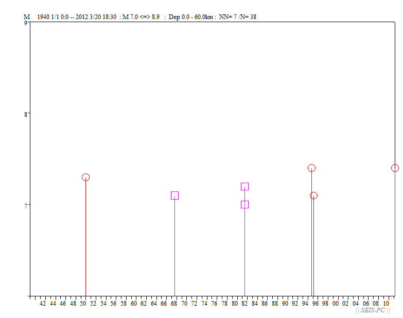 Fig. 4 : Magnitude - time figure in the upper figure. In this region, M7.0 to 7.4 events maybe repeated in 13 to 18 years. 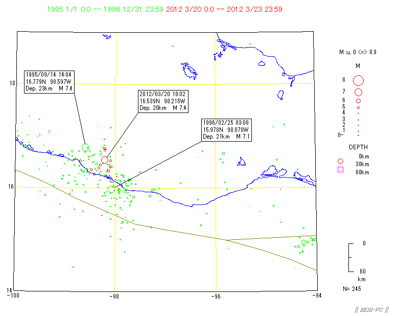 Fig. 5 : The mainshcok in 1995 (3 people were killed) and the aftershock in 1996 were shown in green. The mainshock and aftershocks were shown in red. These events looks like the area between 1995 M7.4 and 1996 M7.1. 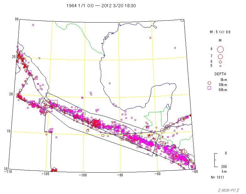 Fig. 6 : The epicenter distribution from 1964 M>=5. 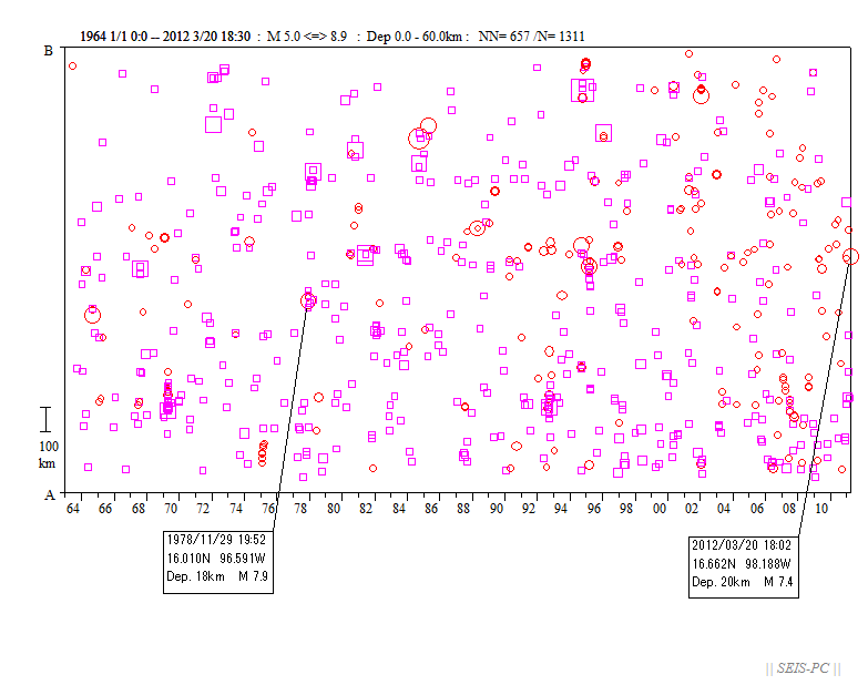 Fig. 7 : The time-space distribution along AB line. This time, precusor quiecence was not obsearved like 1978 M7.9 case. 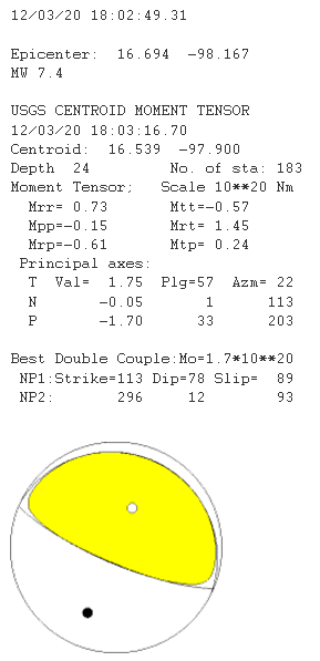 Fig. 8 : CMT solution obtained by USGS. Cocos plate is subducting under the North America plate. 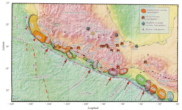 Fig. 9 : Source area of major events occurred between Cocos plate and North America plate(Kostglodov & Pacheco,1999). 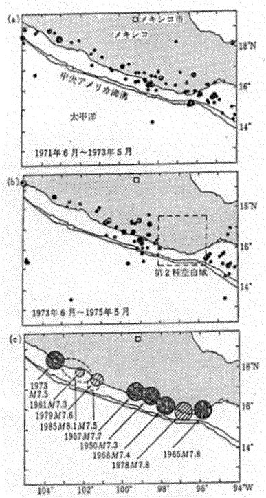 Fig. 10 : Ohtake(1978) pointed the low seismicity just before 1978 Oaxaca M7.9 earthquake. Top page |